

Esri GIS Education - news, curriculum, software, tools and more
USA
Joined April 2009
- Tweets 4,238
- Following 684
- Followers 21,298
- Likes 1,910

📆Save the date—Nov 20th!
Get mapping, storytelling & #dataviz advice directly from the 2025 ArcGIS StoryMaps Competition judges. Register for the webinar: ow.ly/gnJ550XnbuP
#StoryMaps #LivingAtlas

The ArcGIS Imagery MOOC is now open! Start learning how GIS and imagery work together to enhance workflows—from visualization to analysis.
ow.ly/u1B630sR1cw
🌎Registration is free, and access to ArcGIS software is included.

Learn how to teach drone mapping in this upcoming K-12 webinar 🚁
Topic: More than Flying: Map-Making with Drones in K–12
When: Nov. 13 @ 4 PM (PT)
Register 🔗 ow.ly/LFnT50XnbgJ

Planning a map‑based activity for your next lesson? This post offers practical steps to create compelling map‑based tasks that engage students, embed interactive maps, and prompt deeper thinking with spatial tools.
Learn more: ow.ly/6GjW50XlckP

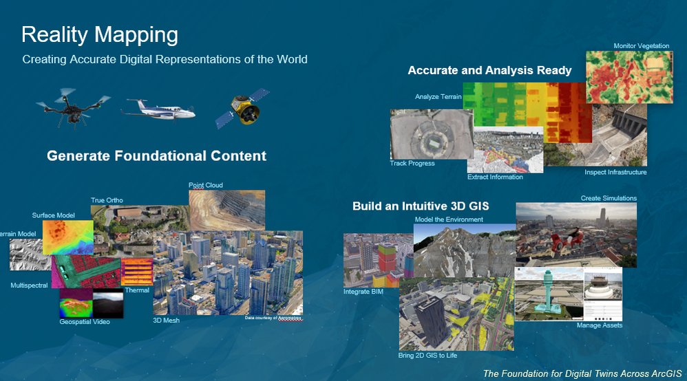
Esri’s ArcGIS Reality platform blends reality mapping + GIS technology to transform how we understand our surroundings.
Educators use this resource to help your students see the world in a whole new way 🌍✨ ow.ly/h5oq50XnaRZ
Join Charlie Frye & the Florentine Films team for a live stream on Mapping the American Revolution 🗺️ ow.ly/6aV450XnaGj
Discover how modern cartography & GIS reveal new insights into U.S. history and storytelling.
📅 Nov 18 | 🎥 Live on LinkedIn

#GeographyAwarenessWeek is November 17-21 🌏 This year’s theme is Making Spaces of Possibility, exploring the many ways geographers open up and explore new ideas.
Find out how to get involved in #GeoWeek ❗ ow.ly/FXqf50XlX7m
.
@theaag

Heading into a classroom for GIS Day 2025? This Teacher for a Day guide walks you through planning, presenting, and interacting with middle/high school students around map‑based activities.
Get your copy here: ow.ly/GrkJ50XmSvH

At Temple University students are using mobile mapping tools to collect field data and analyze their campus environment. This shift from traditional equipment to intuitive technology is helping students gain practical #GIS skills.
Read their story: ow.ly/Vxor50XlcJr

Help students understand the geography behind political boundaries. This post introduces a new classroom activity on redistricting and gerrymandering, showing how maps influence representation and why spatial thinking matters in civics.
Read more: ow.ly/MLEH50XlcFA

Want to update your #GIS curriculum? Check out this article on spatial analysis as a foundation for modern GIS instruction. Get ideas for labs, projects and meaningful mapping tasks.
Read more: ow.ly/Hzb150Xlc9a

How do rivers and streams run to the sea? What is their impact? Explore this map of "Where Rivers Run" using MapMaker with your students 🗺️ow.ly/Po3050Xl8lx

Kick‑off your Earth science unit with engaging GIS‑based activities on topography. Explore three ready‑to‑go teaching tasks that help students map landscapes and surface features.
Learn more: ow.ly/7qTC50Xlb7A

What causes shortages in the water supply for cities and countries? Explore this activity with your students to promote geographic thinking using National Geographic MapMaker 🗺️ow.ly/wXGA50Xl819

How can CTE programs help students build in-demand skills for today’s workforce? This story map shows how #GIS fits into career and technical education, supporting real-world learning and future opportunities.
Take a look: ow.ly/855m50Xl86q

4-H programs are helping young people build spatial thinking skills and explore their world with #GIS. Discover how these students are leading projects in their communities.
Read more: ow.ly/xB0p50Xl8k6
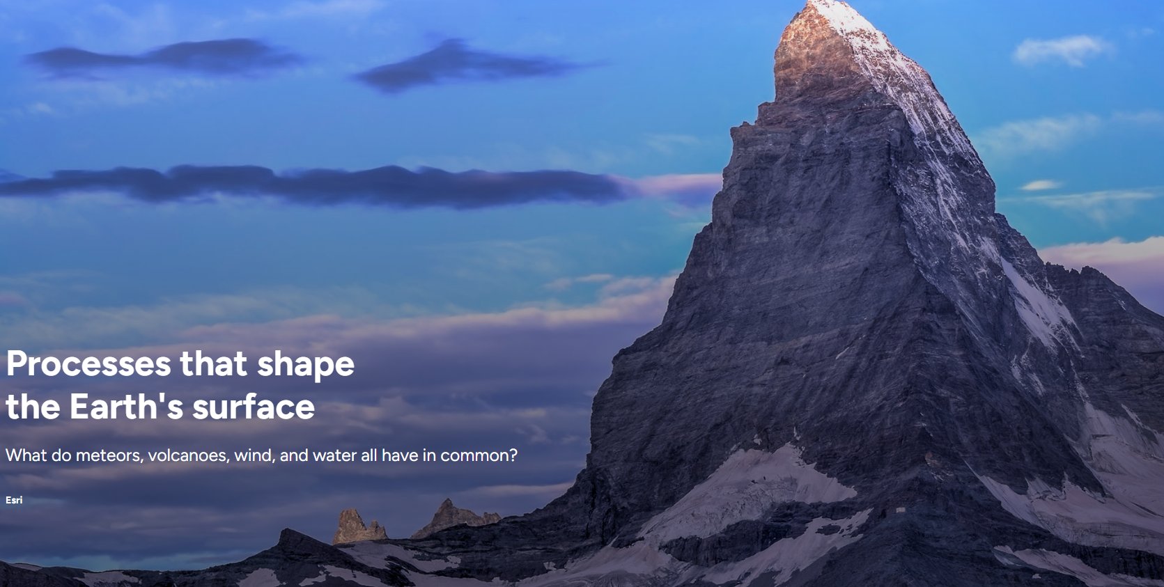
What do meteorites, volcanoes, wind and water all have in common? Explore erosion, deposition, impact craters and more in this MapMaker lesson 🌋ow.ly/pUHk50Xl7HC
Explore how drones are transforming GIS education. This story map highlights practical ways to integrate unmanned aerial systems into GIS programs, covering planning, data capture, processing and classroom use.
Learn more: ow.ly/rEoM50Xjr64

Bring drones and GIS together in K–12 education. In this webinar you’ll explore hands-on workflows, classroom strategies, and best practices for integrating drone mapping.
Learn more: ow.ly/UNbx50XiHvQ

AI is changing how we teach and learn #GIS. Join this month’s discussion to explore where, how, and why to use AI Assistants across ArcGIS Pro, Survey123, Business Analyst, and more.
Secure your spot: ow.ly/9LqN50XjqWv
